Description of the Demonstrator
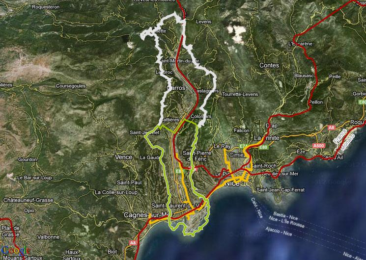
The Var is located in Alpine area (southeast of France) and its characterized as torrential river with steep slopes.
The river Var has a total length of 114 km, with the Tinée, Estéron and Vésubie as its main tributaries cross five main sub-catchments (Tinée, Estéron, Vésubie, Upper Var, and Lower Var).
Éco-Vallée is a driving force of the Nice Côte d’Azur eco-metropolitan area. With its long term vision, Operation of National Interest (OIN), at the same time Éco-Vallée is an international business center of the French Riviera, an urban technopolis with a a dense public transport network and soft mobility infrastructure.
The project offers a long term vision projected for the next thirty years. The focus is on the redesign of all aspects of the Plaine du Var in order to give it a new face. As a first step, priorities have been established for the actions to be carried out in the next fifteen years; and further adapted over the years.
Through the consultation with all stakeholders, three key orientations were defined for this territorial project:
- To restore, preserve and bring value to an altered, constricted stretch of land.
- To ensure the sustainable development of this strategic, but disorderly territory
- To stimulate strong economic and social dynamics throughout the metropolitan area.
Each of these three major guidelines is an essential component of the global vision that will enable the Eco-Vallée territory to regain its full dimension.
Context
Environmental and Geographic context, climate conditions and problem description concerning hydro-meterological risks.
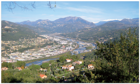
The river section concerned in this project is the Lower Var in total length of 22km approximately, which was previously running freely between the valley slopes. Those featured large, very mobile gravel bars composed of coarse bed material. From the early 19th century on until the 1960s the river was canalized over the entire length of the lower valley, reducing its width (cross section) from about 1000 m (in average between valley slopes) to a 300 m, and even 200 m in the last cross sections close to the sea. To compensate the lowering of the river bed as a result of the extraction of building materials, fixed weirs were constructed to bring the water table back to its original level.
The plaine du Var’s often anarchic development throughout the 20th century, has given it many of the characteristics of an economic suburb of the Nice municipality.
With its 116 000 inhabitants, exceptional landscapes, and range of economic activities, this territory is recognised as an area with the potential for the new approaches and new solutions.
With its geographic context and Mediterranean climate existing hydro meteorological risks call for new solutions. The NBS fit quite well in this area combining traditional and new approaches in managing flood risks.
Implementation
The Var Eco Valley in the Lower Var river basin, is a flagship project of the French Government and represents an innovative approach to manage and combine different environmental challenges, including the hydro-meteorological events in suburban and urban areas. Different measures in the valley and upstream of it have been implemented such as:
- Green dikes, combining the increase in retention capacity with the enhancement of habitats.
- Installation of eco-district in the upstream part of the valley in the village called St Martin-du-Var
- Water – Flood reduction.
- Improvement of the ecological condition of the river.
University Nice Sophia Antipolis UNS
ÉTABLISSEMENT PUBLIC D’AMÉNAGEMENT NICE ÉCOVALLÉE
- Mainstreaming NBS and flood risk management into larger contexts (smart cities, energy efficiency). The new district within the city is built focusing on smart city, energy efficiency and smart water management. The urban planning of this area is adapted to the existing flood risk and biodiversity potential of this area.
- The Eco valley is supported by French government and it stands as a flagship project of the French government.


